|
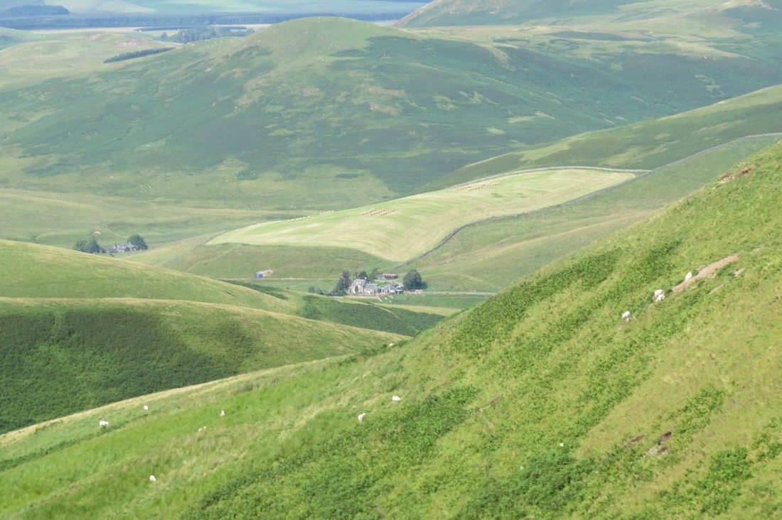
Starting the day with little excitement, just looking forward to finishing this trek. I was driven back to Trows farm to re-pickup the Pennine Way. It was overcast cool and drizzly, jacket on early in the piece and camera in bag. Not content to walk back up the downhill track I used the day before, I planned an alternate route via an ancient footpath "Clennelly Street" which joins the PW to the North East of Windy Gale. So I walked the lonely less used road and got back on track. Thereafter it was more like yesterday up and down in boggy muddy ground with very little in the way of paving slabs. I avoided the chance to divert up to the Cheviot peak (would have added an extra couple of hours) and also gave up the thought of looking for an aircraft wreck in the area. I took the low path option down into Kirk Yetholm and met up with Jean at the pub at about 5.00 pm. That's it, finished, all done, game over! Had a final dinner with Denise and Billy then off to our room, took ages to get to sleep the room being stuffy with no ventilation coupled with my midge bite induced discomfort. I got mauled by the midges whilst using the bathroom in my earlier accommodation.. I made the mistake of leaving the window partially open overnight and leaving the light on which attracted the little critters.
I am pleased to have completed the walk, it was an interesting experience and made some new friends and had some nice times. I learnt a bit more about the country and myself.. you can't help doing so when left to your own devices for hours and days on end! I like long distance walking in the UK, but I will not be doing this one again.. next year? I have no idea, my worn and grubby boots have been chucked in the bin and will have to be replaced. Next job is to get this blog published. cheers wal
0 Comments
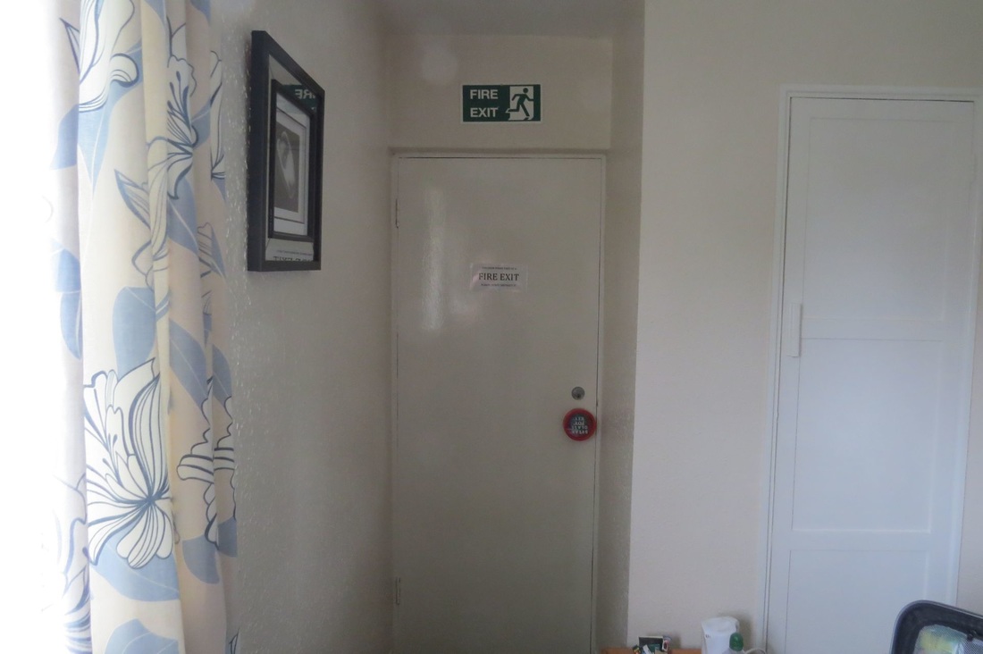
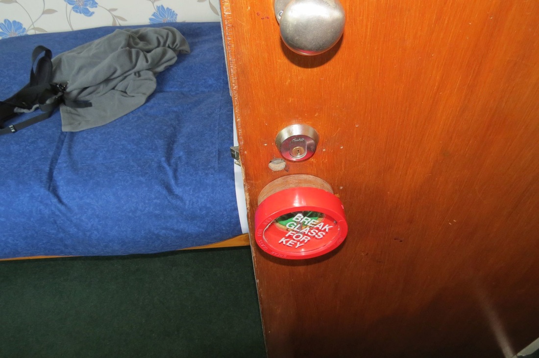
I am staying at the Forest View Inn, not a bad place to stay for the night (I am staying for 2 as I am splitting the last leg in two) , my single bed room has an interesting quirk. My room is a fire exit..so you say that's fine I can get out if the place lit up.. well yes BUT its not just a fire-escape for me, it is an escape for other residents too, so on my room door there is an "in case of emergency" glass fronted box which contains the key to my room! Lucky I don't attract the ladies like I used to.. I'd get no rest at night (In my dreams)
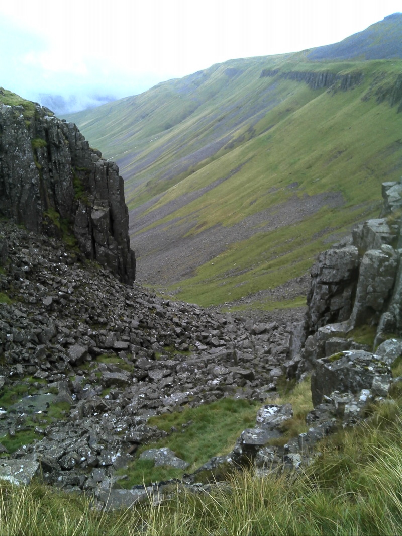
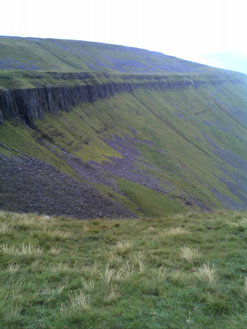
Day was fine cool and overcast so good for walking. The worst part of the day was the first couple of kilometers where a very muddy steep path had to be climbed amongst rampant vegetation.. Bracken and all manner of greenery. The path was so greasy you could not get a good footing and your feet would slip underneath you, the sting in the tail of this apalling ascent was a short 20 foot scramble up a rock face before entering the delights of rolling squelching moors. The path goes alongside a military training area and MOD signs warn that you not pick things up lest they "explode and kill you". At times the path was not well defined and a bit of hunting around was required to find it but for the most part it was ok. . This section of the walk, whilst weaving in and out of Scotland, passes ancient sites including Roman camps and follows the Roman Road "Dere Way", signs warn you to not dig , drive over or metal detect in these areas. At last the turn off point was reached where I descended a very nice grassy path down to Trows farm where I had to wait for an hour for the Forest View bus where I would be staying for the second night in a row and to meet up with Billy and Denise again. Pics looking back on the terrible climb and Byrness.
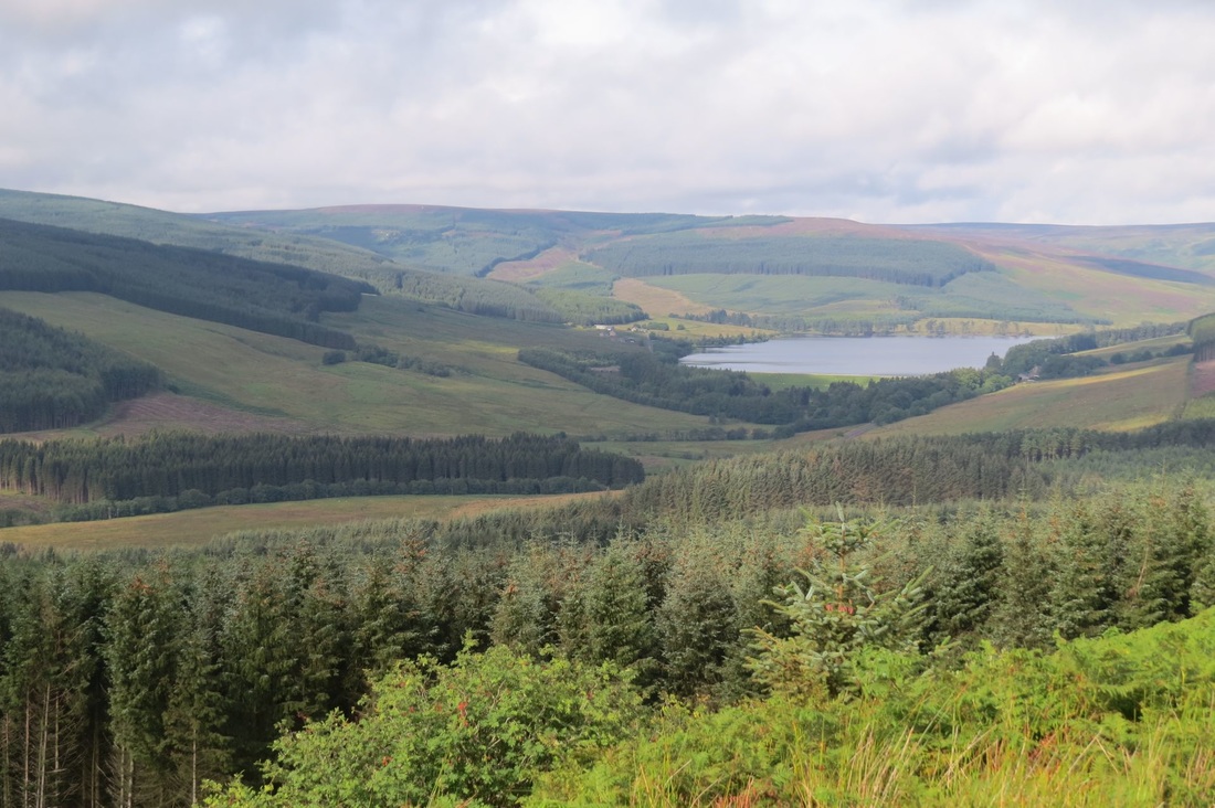
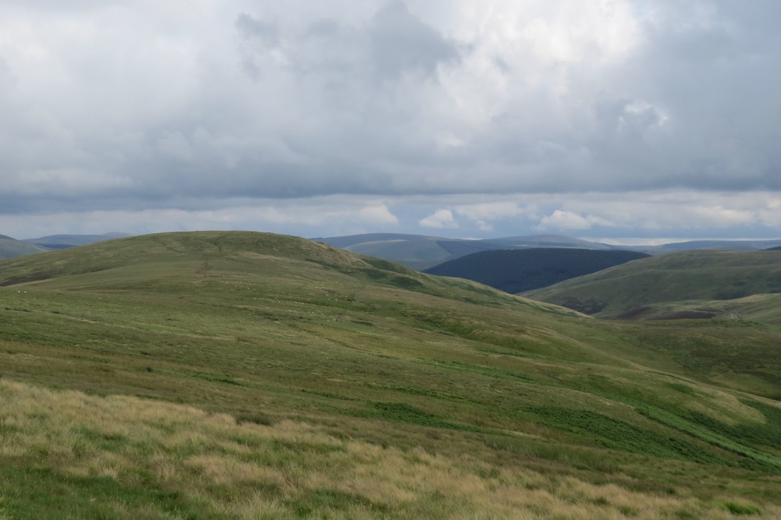
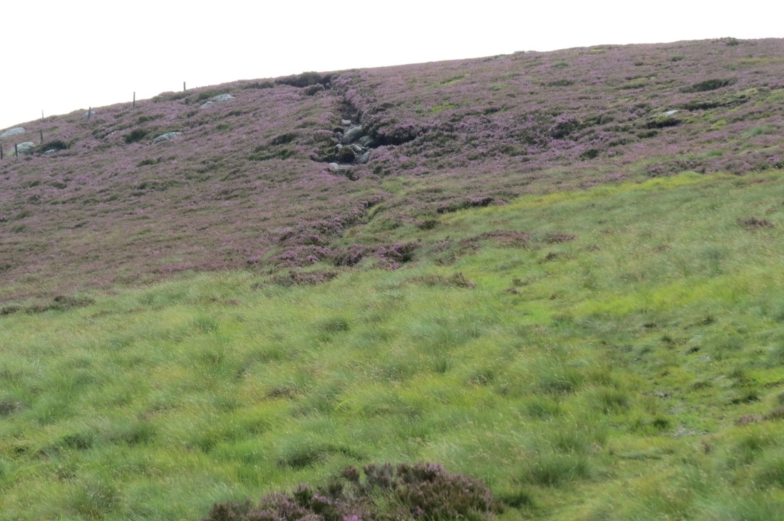
Views of the Cheviots
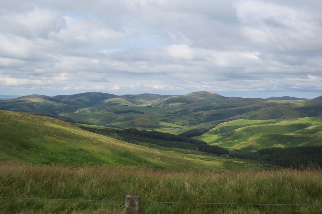
After overnight rain the day became cool, overcast and dry..in short nice walking weather. The first third was reasonably pleasant farm pasture walking going into fell moorland. All ok keeping feet dry for a while until a climb alongside the forestry boundary fence was required.. things got super squelchy but walking on the remnants of a collapsed wall footings kept the feet relatively clean and dry until the footings ran out, therafter it must have been at least an hour and a half of walking on squelching moorland grass, moss and other associated vegetation with feet unavoidably disappearing up to the ankles in water. Several other walkers walking on this day revealed they avoided that patch by joining the forestry road earlier.. that saved their feet and socks and probably at least 30 mins time! ( To add insult to injury they told me they had avoided that really bad boggy bit before Gilsland also by staying on a road!) My only excitement was a pair of Army Apache helicopters passing over at low level just before I got o the squelchy part. That last third of the walk was mostly on blue metal gravelled forestry track, where my pace picked up quite a bit. My learning experience for the day is that pine trees seem to thrive in super wet ground and boggy conditions, crikey they have their roots in the wetness much like mangroves have in tropical coastal Australia.
Forecast for today was overcast with light rain and so it proved to be. I got away without wearing a jacket for a while but when water drops began to fall from the brim of my akubra it was time to put it on. The first part of the walk was continuing alongside Hadrian's Wall, passed the interesting remains of a Roman milecastle before veering off to the North away from the wall. Back into rough pasture / boggy moorland. No longer crossing becks gills and streams, now crossing burns, must be getting close to Scotland. Not much to commend this part of the PW, boggy and muddy, such few slabs that have been laid , were 6 inches under water and invisible, one had to "tap tap" like a blind man with the stick to make sure there was actually a slab there under the water. A few times, the stick pushed into a bottomless muddy hole. Through the moorland the path is confused with numerous sheep trails, if you dont have a GPS, you have to keep a compass course to get anywhere near the next waypoint / stile / gate / post. A fair bit of the walk was through pine plantations.. the path here was as boggy as hell, made worse by the passage of horses which really churn up the mud, met up with Danny a Belgian walker I have bumped into several times over the last few days, we don't really walk together, we just go at our own pace and are usually in close proximity.. he is quicker than me but I don't stop to take breaks
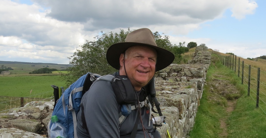
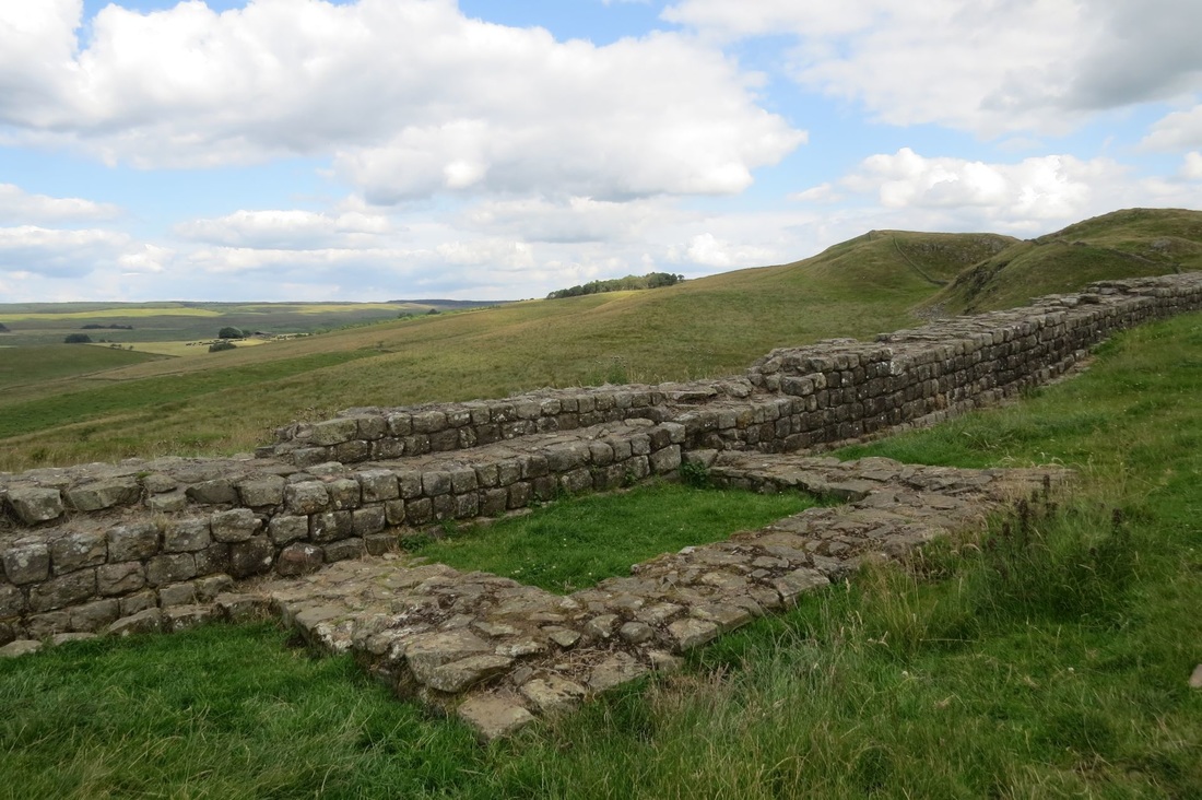
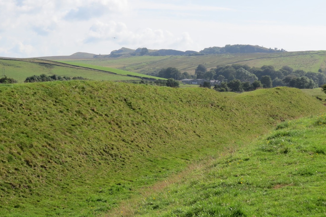
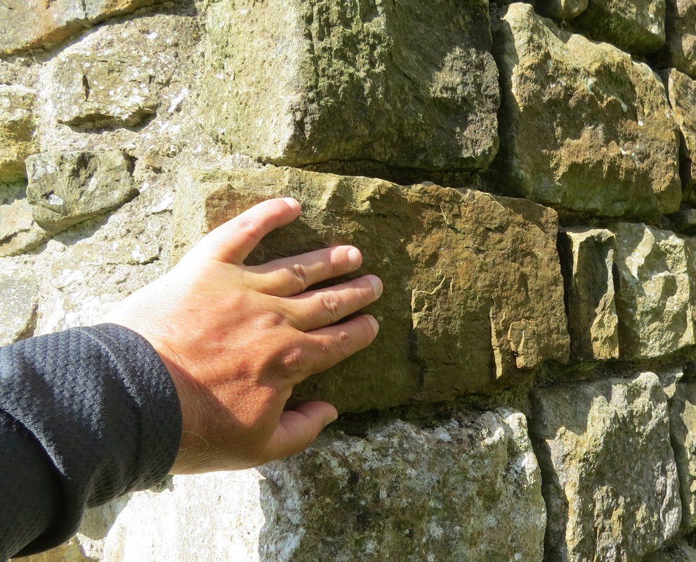
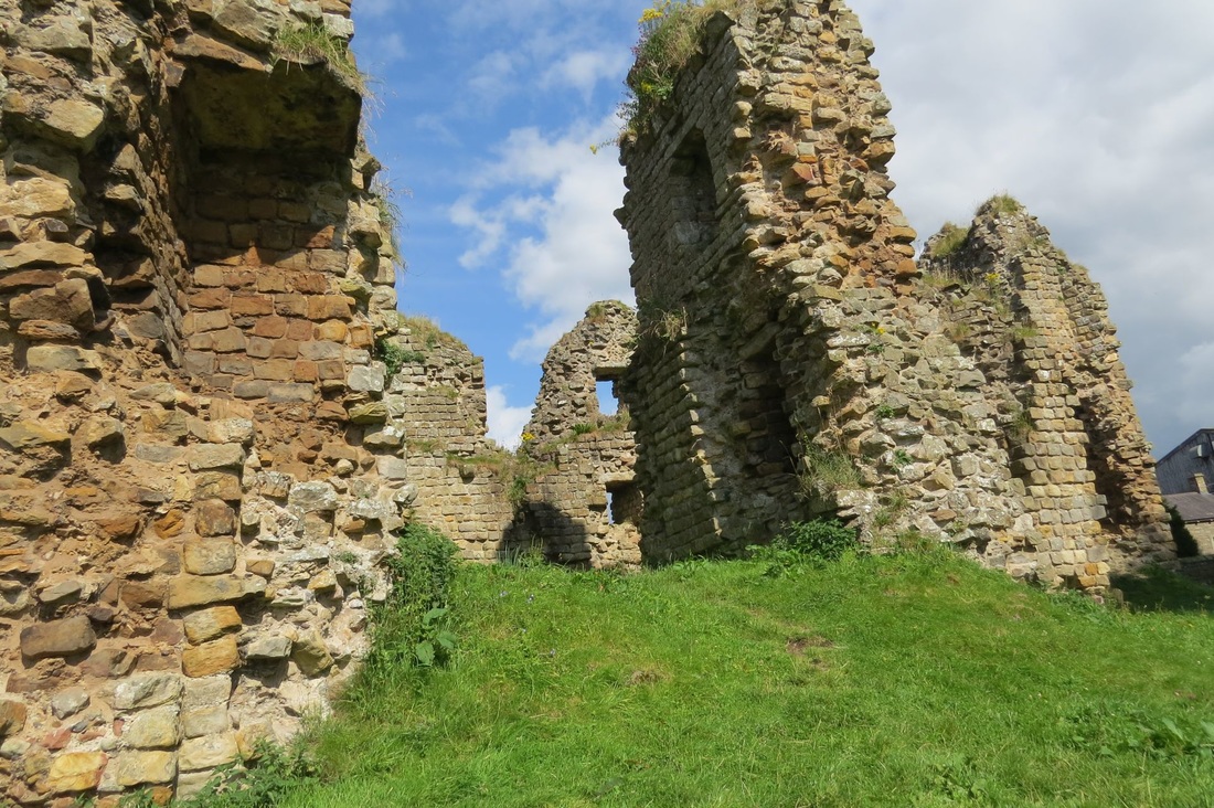
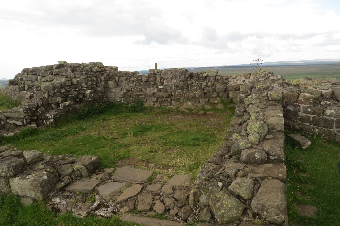
 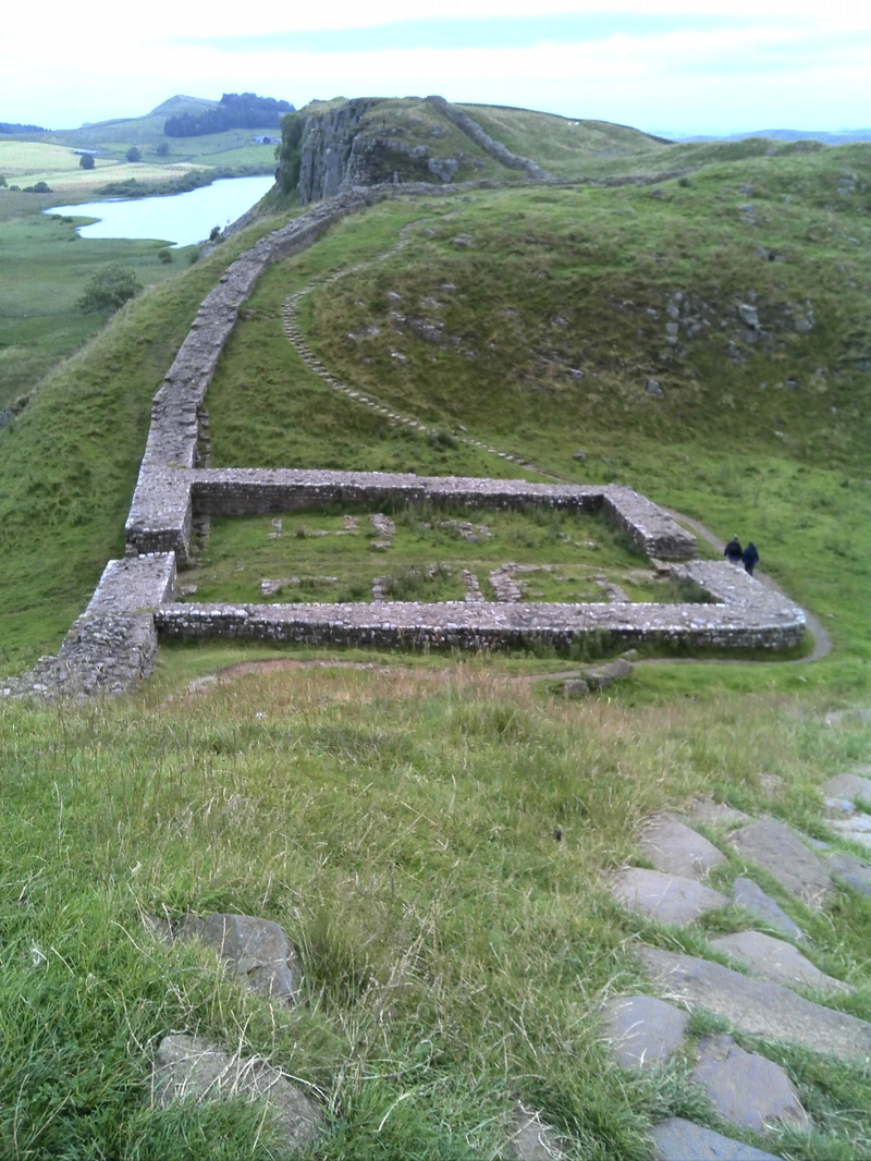 A fine dry day! I managed to keep my feet and boots dry though I was drinking more water due to the warmth of the day and the exertion of constant ups and downs of the wall..you see the Romans cared very little for the welfare of their enemies (or even their allies and own soldiers come to that!), the wall goes up and down hill, looking at it as I walked along it it just beggars belief that this wall was built in 12 years, the amount of rock that was used (the facing stones all nicely squared and mortared, internal stone undressed), plus the digging of a bloody great ditch must have taken a tremendous amount of man power. Anyway I touched some stones that had been shaped and placed bloody near 2000 years ago, I took a picture of my hand on the rock thinking it was pretty significant for me. At one stage a ladder stile had been placed to go over the wall to allow access to some marginal looking grazing land on the other side, at this stile on the other side of the wall stood this fine looking horse, I stepped up on the stile, did a bit of horse whispering, it came towards me and was able to stroke it. I took out one of my oat bars and shared it with Neddy, it could not pick up the bar from where I laid it on the wall, but it definitely wanted it and was getting a bit frustrated it couldn't get hold of it, so I risked my fingers and held it out on the palm of my hand and held it under its mouth, its lips grabbed it and it munched away contentedly, me pleased with the fact my fingers didn't get crunched as well! Shortly after I reached the road which I used to descend down to my digs for the night, A pub stood along the way so I stopped for a pint and a late lunch. Despite my better judgement I ordered a Burger...the Brits, bless them, cannot make a decent burger to save themselves but I live in constant hope and try my luck occasionally, once again disappointing, 5 out of 10. Honestly I'd prefer a Hungry Jacks burger to what is commonly offered. (I had one acceptable burger about a week ago not bad after 3, 3 month long visits to the UK!) The pictures that follow are the Vallum (roman dug ditch) the remains of Thirlwall castle which used stone pilfered from Hadrian's wall, who else has touched this stone in the last 2000 years?. Remains of a mile turret on the wall.
The day started off fine and cool with little wind, it went overcast in the afternoon but remained dry. I used The South Tynside Trail ( a mostly disused railway side path) as my preferred option to start the morning.. navigation is way simpler, no stiles just gates, sections of this though were quite wet and muddy. Getting off the Trail on to the PW I first entered marginal farmland (sheep grazing) then alternating with moorland. This section is poorly signposted. There are paths in the moors but they go all over the place and to be frank I think most of them are sheep tracks and traces of long lost souls who never found their way out before sinking out of sight into the mud.. There are no posts or cairns to aim for and I rapidly found myself off track by following a trail. The GPS got me back on course but I never did find the right path even when the device said I was right on it. If I were doing this section again I would take a compass heading to my destination stile and follow that heading, you are going to get your feet wet whatever you do (I went in right up to my knee in one place, it took me several pulls to get my leg out from the sucking mud) so just go straight till you hit the wall or fence and find the stile. All in all this day's walk had very little to commend it, I just wanted it to be over and I couldn't get to my accommodation soon enough though I had to risk life and limb walking along the A69 to get there. Folks the Pennine Way is an ordeal, it is just a mission I have to finish and fulfill, I aint ever going to do the PW again! Pics: a Thomas tank engine look-a-like narrow track engine of the South Tyne Trail rail line. Many times in our stays in B&Bs in the UK we donate a quid to the save the Red Squirrells fund, I have now done 3 long distance walks and have never seen one, I think this wooden carving probably entirely funded by my donations maybe the only red squirrel I will ever see.  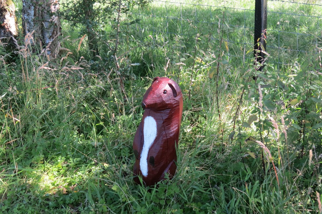 Yesterdays rain had passed in the night so the morning was fine and very cool, cloud covered all the hill tops. My accommodation was "off track" and rather than double back about a mile to join the PW, I had devised a track that would get me going in the right direction and allow me to join the PW further North. The path I had chosen was by quiet country road to Knock then using various farm tracks and footpaths.. Well! Wasnt that surprisingly difficult! The paths were not well sign posted, the GPS map did not correlate to the tracks very well so I had to move in what I thought was the right direction to check that I had in fact taken the right option. These footpaths are obviously little used, the grass is long and being very wet from yesterday's rain, walking through it soaked my trouser legs and drowned my feet without even having to wade through puddles that abounded everywhere. At one point, having crossed a river I found myself in a walled field, the GPS told me I wanted to be the other side of that wall, I was walking around the field and along the wall looking for a stile to cross over but there was none. I must have painted a very comical picture as I zigged and zagged through the sopping rough grass and vegetation (in my mind I was hearing Benny Hill sketch music) I was buggered if I was going to retrace my steps so I prepared myself to jump the wall (easier said than done if you are a clumsy fat bastard like me), just as I was going to hoik ( a good Aussie word) myself over I spotted a stile in a fence that was on the other side of my intervening wall, aha proof positive that the path I wanted was actually there!, but how to get there? I walked back along the wall to the end where the wall had collapsed and some rolled up wire netting had been placed to fill the gap, I could see the path, about 3 meters the other side and lower down on the river valley side. Ok I said, I just shift the wire netting.. great gap made, now to step over the fallen rubble of the collapsed wall, easy does it, place hand on intact portion of wall to keep my balance, truely I barely touched it , hardly put any weight on it at all and another meter of fine cumbrian dry stone walling collapsed around my feet! Whhoops so I pulled out some extra wire netting from the roll covering the slightly bigger gap then hightailed it down to the stile. Once through the stile there was no visible path so I followed the line in my GPS and about 15 mins later even the experience of wading through a 6 inch layer of sheep shit to get through an open gate could not dampen my joy where I rejoined the PW. From there an interminable climb in ever deteriorating ground conditions, into the moorish hillsides feet absolutely soaked. It was windy and got really cold up there so I had to don my jacket. Climbing , climbing, climbing, finally reaching the top of the highest point on the PW. Other walkers stopped to look and take photos, I just kept going! The next bit was downhill in the same boggy conditions, I zigged when I should have zagged again through a moment of inattention, this plus my antics earlier on added to the mileage expected for the day. The downhill path is called Corpse Road as it was used by the people of Carrigil to take their dead down to be buried in consecrated ground many miles away in another village. The path goes through area of sink holes and disused mines. Just to the right of the track a river cascaded into a sinkhole and dissappeared! Many traps were seen along side the paths, aparently designed to catch mink, stoat and weasels that eat the eggs of the endangered black grouse. After a long grind I entered Carrigil to see a wedding procession walking up the hill to the church, I would have killed for a pot of tea but there was no where on the path so I kept going to Alston...another 3 and a half miles, I was dying, I had to climb dozens of stiles and wade through more mud on the final dig. Finally got to Alston and took a bad guess as to where my accommodation was, that was another gruelling climb up to the town centre, finally I asked directions and staggered back down the hill again and 10 mins later dragged my sorry arse into the guest house... I did about 3 extra miles today.
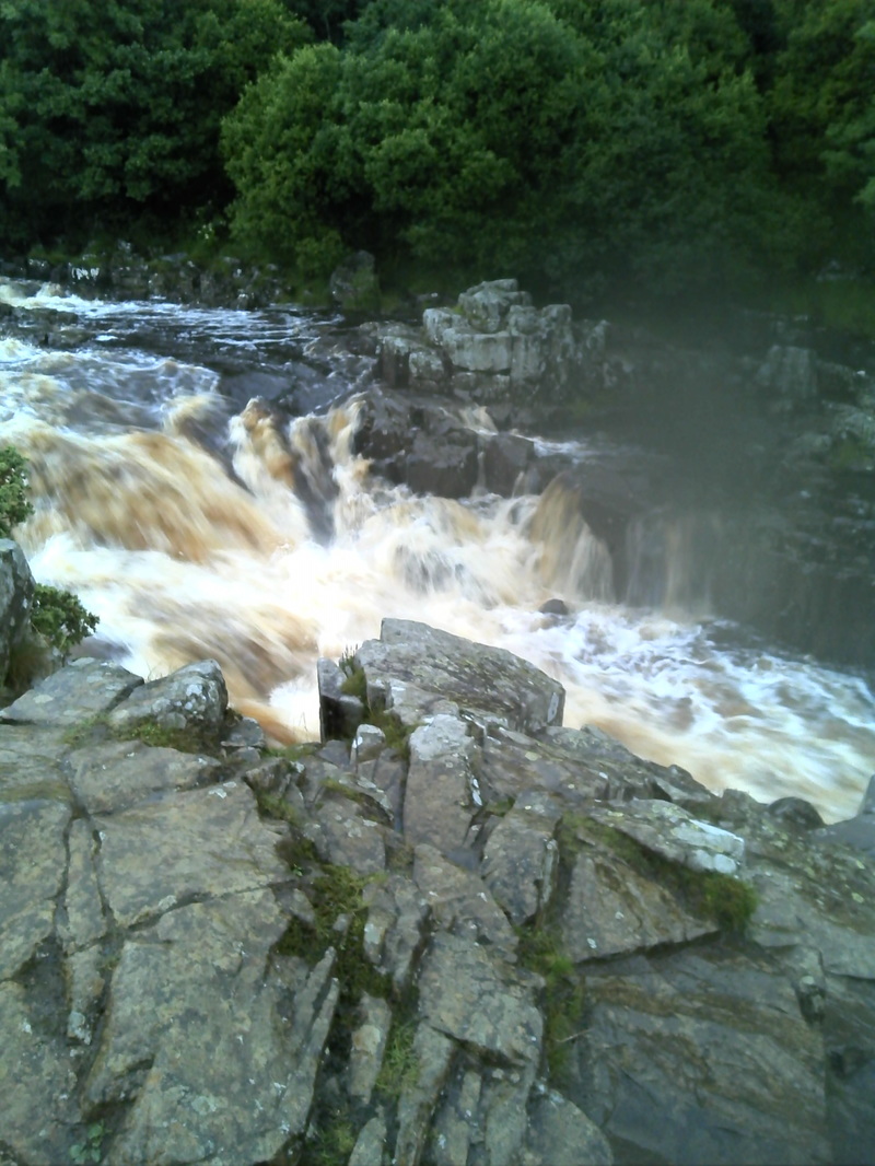
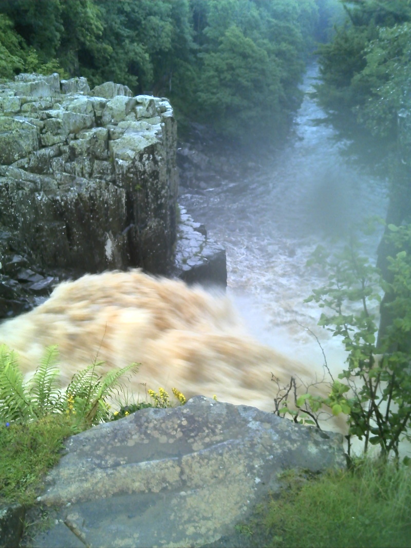
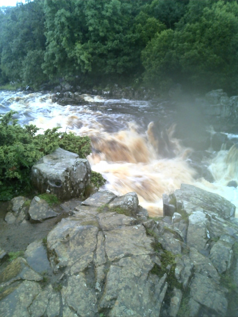
The weather for today was forecast to be crappy and crappy it was, raining continuously for most the day. Because today was a long leg (20 miles) in really isolated country with no easy diversions to civilisation if required in an emergency, in bad weather I did not want to run the risk of not reaching the destination while there was still some light. I knocked 4 miles off the walk by getting my B&B host to drive me up to join the Pennine Way before High Force. I don't like to cheat on this but the conditions proved to have warranted the move. (I found out later that that morning a person died at High Force Falls) The walk followed the river Tees for most of the way, with the large amount of rain that had fallen the river was wild and frothy and had broken its banks in several places and covered the riverside path with 18 inches of water in places. At first time and energy was used to avoid puddles and pools and muddy bits in a vain attempt to keep feet dry. After fording streams with water at mid calf level one was now freed of the need to keep dry. So liberated, easier walking resulted now just splashing through water without diversion the pace became quicker. For the first 3 hours I did not see a soul, it was very lonely and a little bit scary to be so remote in those conditions. At one point on the riverside path, the path was actually non existent as there were 3 separate rock falls that had strewn boulders haphazardly down the slope all the way into the water. the pace slowed considerably while I picked my way between and over slippery rocks often with one foot in the river, negotiating the last of these rockfalls I saw I had caught up to a couple of walkers and felt some relief at their presence.. The path now climbed up and into a scramble alongside a torrent of a waterfall (Cauldron Snout), this was wet, slippery, arduous and a little scary, culminating onto a mostly dry gravel roadway for a few miles of welcome change and faster pace. I overtook and walked with Liverpudlians Billy and Denise who i had not seen for 2 days now. Soon we had to leave the road and got back onto sodden riverside paths with many streams needing to be forded, then across a bridge and a gentle climb on a beautiful wide soft grassy path culminating at High Cup Nib. This feature ( a glacier gouge) was quite impressive, fortunately only a little of it was obscured by cloud. From the head of this feature the path continued around hugging the edge, the grassy path giving way to rock, mud and streams pretty much all the way down into Dufton. I had to ford severaI raging streams that tumbled down the sides of the chasm meters from where I crossed. I was in fog for the last 3 miles of the walk with the visibility being no more than 250 metres. I staggered into town, passed it, then trudged another mile uphill to my accommodation, the heavens opening up and drowning me again. My Dufton B&B was run by one of those bent old ladies that got around with the help of a stick, the breakfast part was self serve with the bits and pieces for cereal fruit etc on a platter in the room or in the small fridge. The pub was a mile back down the road and because it was still raining I elected to forgo dinner there because it was fortunate that today was the only day that I had a sandwich in my bag that I'd bought in the coop in M.I.T the previous day and had not eaten for lunch. So it was a sandwich for my tea, the room was comfortable enough so an early night was had. The first 3 pics show High Force Falls where someone had died that very morning. The 4th is a bad pic of Cauldron Snout, the stream and waterfall engorged by rain was noisy and wild and covered part of the rock scramble that was required to be climbed to get to the top. A mad scramble up, using my hands to bend and lift my knees to make the next impossible step, mighty grunts then a mighty sigh of relief when I reached the top. Last pics are of High Cup Nick.
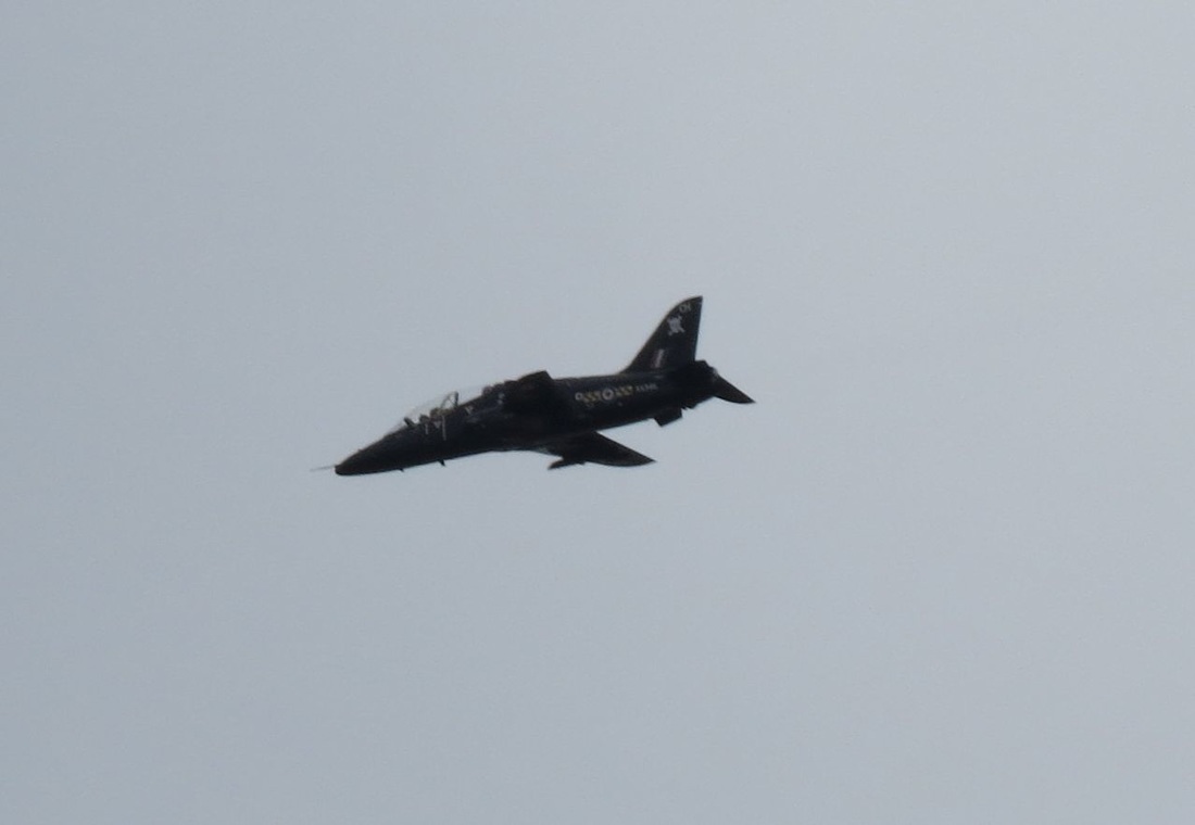
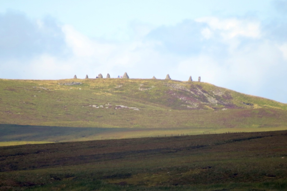
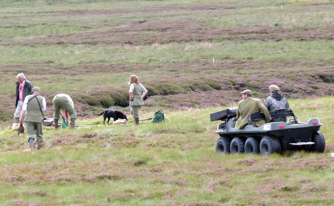
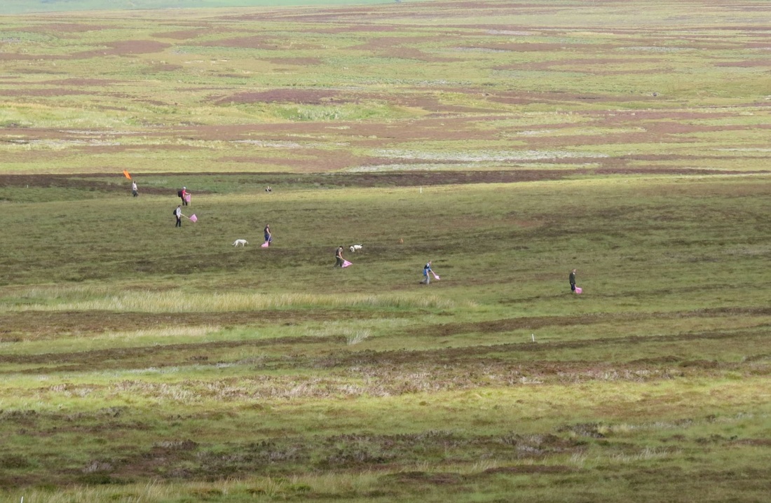
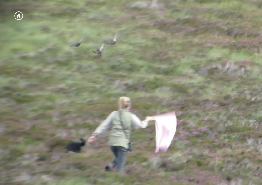
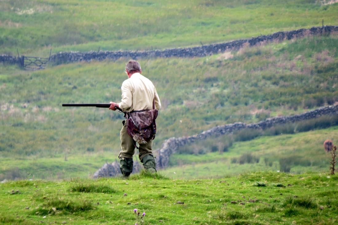
  A fine sunny day and Jean drove me back to Bowes to complete the Bowes loop section of the Pennine Way. This loop is less well sign posted and passes through many miles of featureless moor. Honestly I would have no chance of finding or approximating the trail without the aid of my GPS and the route I had drawn up the night before.. I had accidentally chucked out the first two pages of my guide maps that described the path in this difficult area. The moor path passed MOD firing ranges past and present with sign warning of live firing and unexploded ordinance. At last I passed a small flat topped crag that would serve as an excellent picnic spot and descended into Baldersdale before rising up again through more moor and rough cow pastures to Grassholm Reservoir. On this section a big bloody horsefly bit my shoulder right through my shirt I had to fight the bugger off for a few minutes after that. After that another climb to the hills above Middleton, passing a group of shooters beating their way down the hill in a rabbit extermination mission. Very well dressed these shooters, tweeds, tie, very gentrified. A final descent into Middleton, got buzzed by a low flying RAF Typhoon then back to the B&B shower and a beer.. then to the chippy for some haddock and chips. Picture, Goldsborough crag about a mile easy walk from Baldersdale and would be a great little climb and picnic spot. 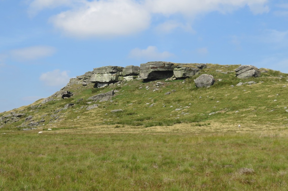 This leg pushes me over the half way mark. Sunny conditions going partly cloudy with little wind made for warm and sweaty conditions and the first uphill hour was a sticky affair. The midges were out in force in these conditions and they were feasting on my already bite swollen ears. Less annoyingly the RAF was out in force also, they were buzzing around mostly in the next valley but several Hawks and Tucanos overflew me. I reached Tan Hill about 2 hours after the start whereupon I walked into the moor in the middle of the opening day of the grouse shooting season. My presence seemed to force a long line of flag waving, dog-accompanied beaters to move ahead of me to startle the birds and inexorably corral them towards the shooters butts (not butts like bottoms but butts like enclosures.. clear? no buts about it?) There didn't seem to be many birds and I was told later that it had been a poor breeding season. After a couple hours of slow squelchy walking I left the moor and trudged my way through mainly rough fields onwards to Bowes where Jean was there ready to take me to our accommodation.
  |
|